 By
By The Tha-Anne River first started flowing through my imagination in August 2019. After 42 days of criss-crossing Saskatchewan, Manitoba and Nunavut, I was descending the very final rapids of the Thlewiaza River when I glanced over my left shoulder and saw another river – the Tha-anne – surging in from the North and merging with my river before the combined current swirled into the icy salt water of Hudson Bay.
As I mentioned in my book, Perseverance, Life and Death in the Subarctic, at the time I thought that maybe, someday I would return and explore that river too. Well, someday came and in early July I headed out to the Northwest Territories to begin the journey…
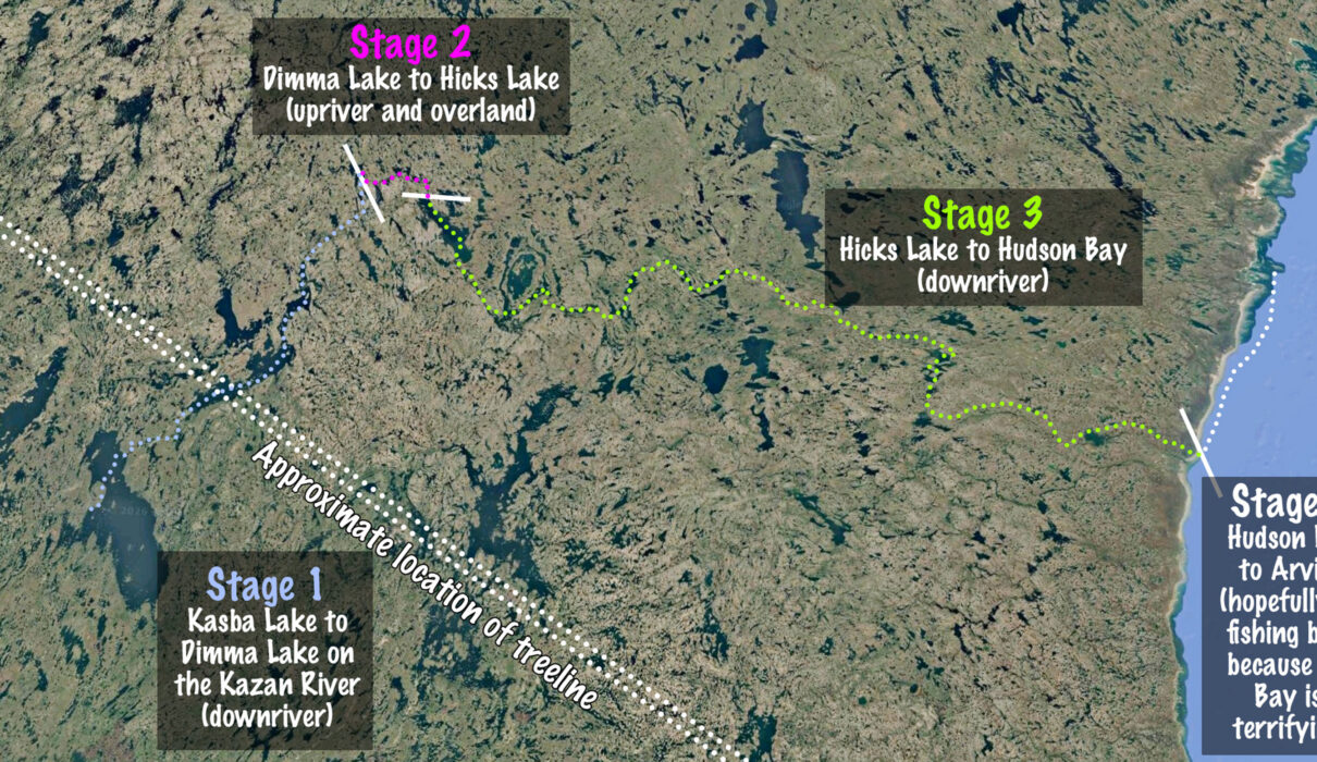
The Tha-anne 2026 Expedition Consisted of Four Stages…
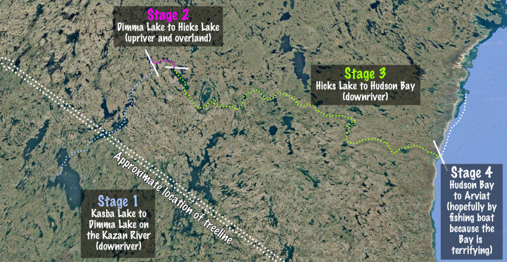
Stage 1, Kasba Lake to Dimma Lake on the Kazan River (downriver)
The trip started in the boreal forest as it falters towards the treeline, just to the north. I descended the upper Kazan River down to Dimma Lake. Most travellers would continue northwards on the Kazan towards Baker Lake, but at this point I made a hard left and headed upriver.
Stage 2, Dimma Lake to Hicks Lake (upriver and overland)
This was the shortest stage distance-wise also onethe most challenging and slowest-going travelling of the trip. I waded and tracked upstream in mid July, a time when the bugs were fierce and the little creeks werebe brimful with meltwater. The final portion to connect the Kazan and Tha-anne watersheds involved extensive portaging and route-finding, requiring a minimum of 3 loaded carries and 2 return trips because I’ll still ade a lot of food at this point.
Before the trip I knew of one person (Calem Watson) who had done this short section in the opposite direction from me, so I knew it’s possible, but other than that, there was very little information about this section of the trip.
Stage 3, Hicks Lake to Hudson Bay on the Kognak and Tha-Anne Rivers (downriver)
From Hick’s Lake to Hudson Bay is downriver, so it should have been easy going, right? Hang on a minute!
First of all, there is a ton of whitewater as the river falls 291 meters (almost a thousand feet) off the plateau on which it was born.
Secondly, this river is very poorly described. The only written source of which I’m aware is a missionary’s report from the 1800’s by the Reverend J. Lofthouse. He didn’t have a ton of details, and also didn’t go as far upriver as I started. Other than that, I had chatted briefly with a paddler called James deMello who did the Tha-anne (but not the Kognak) in the 1980s, and Cliff Jacobson who cut across to the Tha-anne from Seal Hole Lake on the Thlewiaza with a group that then flew out before they reached Hudson Bay.
Anyway, it turned out that this section was a LOT tougher than I expected; essentially it was a staircase river, where the wind opposed me on the flat sections and the river convulsed itself into manyi mile-long rapids of great severity ranging from class III to class VI.
Stage 4, Mouth of the Tha-Anne River to the town of Arviat (open ocean)
Hudson Bay is an awful place for canoeing.
The massive 10-14 foot tides, combined with enormous tidal flats, combined with a dense population of polar bears makes it an extremely anxiety-inducing place. I had paddled portions of the coast before and also have seen 14 polar bears in 24 hours on a different trip, so I wanted to avoid paddling the coast if at all possible. My plan was to contact Inuit friends of mine in Arviat and have them pick me up with a motorboat, but if communications failed, then I would have been looking at 100 km of terrifying paddling with very little sleep.
July 6th
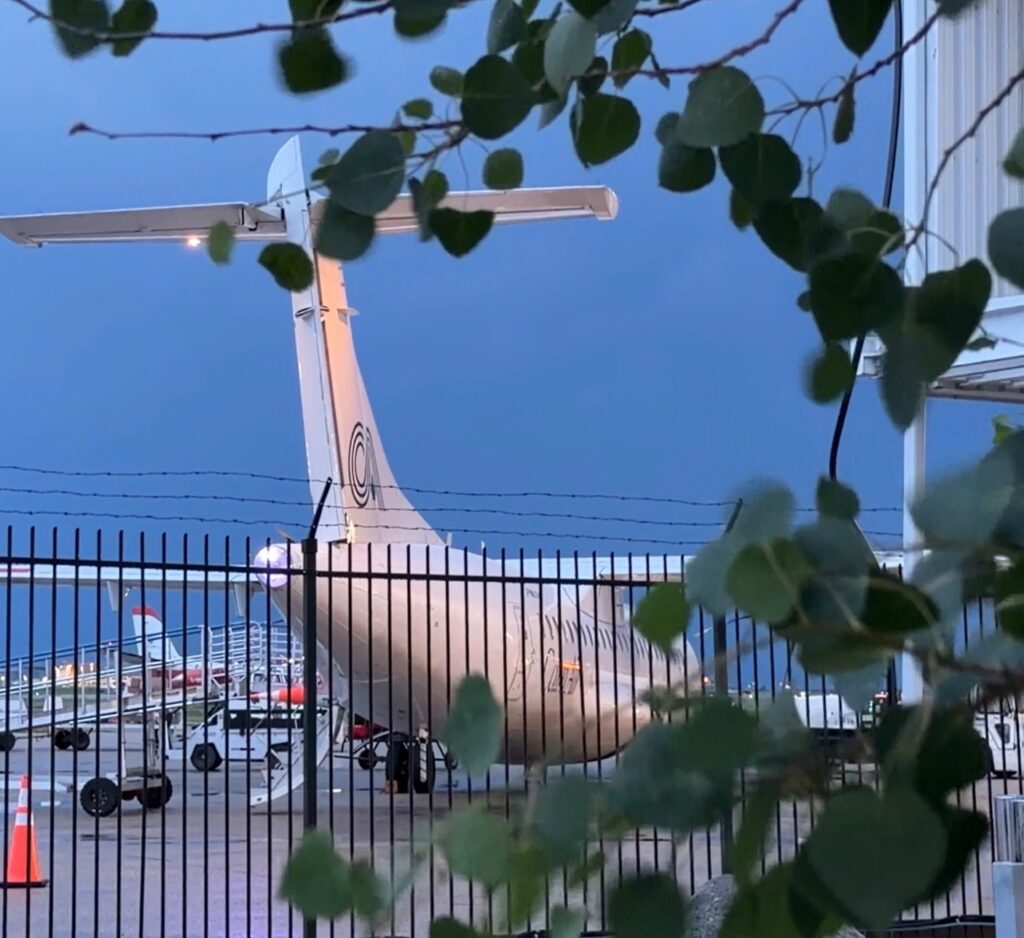
Today started early, long before dawn as I made my way to the part of the airport reserved for northern airlines and charters. About 20 people boarded the Calm Air Charter, all bound for Kasba Lake Lodge: 19 fishermen and me.
After an unscheduled stop in Thompson Manitoba for emergency maintenance we finally made it to the lodge. The thick cloud and bumpy landing suggested that the weather report were correct: there were very rough conditions on the lake.
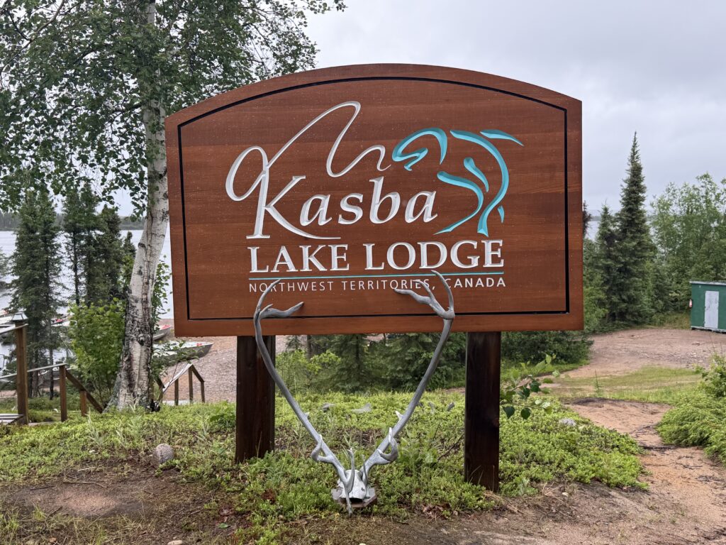
The lodge is beautiful and full of people, hoping to bag record pike, lake trout, and Arctic grayling. I don’t fish on these trips, but if I did, it would be good eating every day.
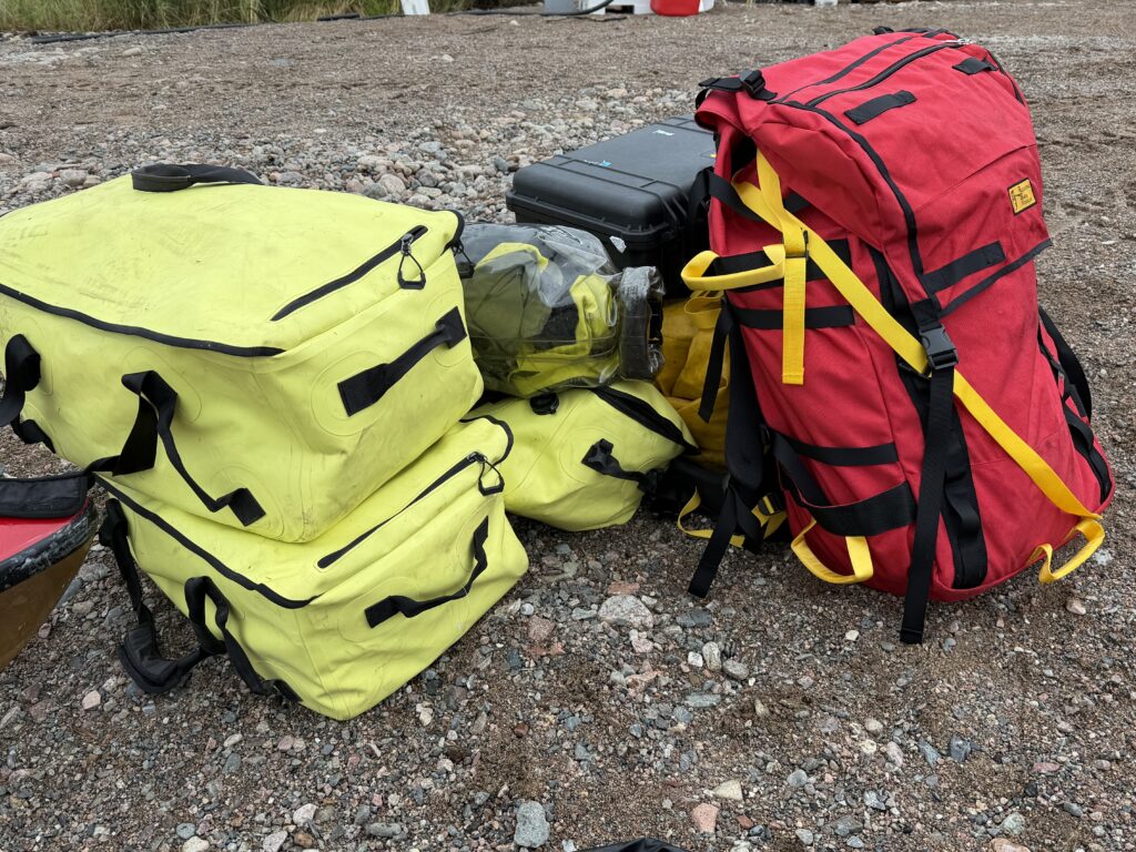
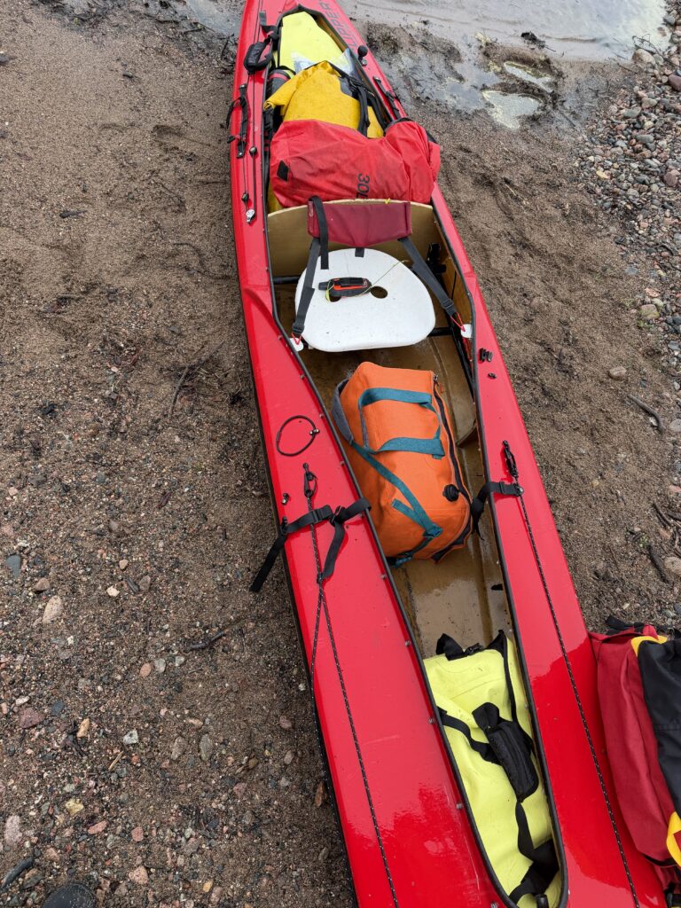
Fortunately, the gear shipped to the lodge months ago was all here, and it took about an hour to load and prepare the boat with the eavy stuff towards the bottom at all costs. Even with 140 pounds of food (rectangular yellow bags) it almost all fit under the spray deck, just my camera gear and some paddles needed to go above it. This made for a stable boat that would keep most of the water in the lake. Pl
The fishing guides at Kasba Lake were very friendly and helpful, but they reported 4 foot rollers out in the middle of the lake. This was a problem for their 20 foot long aluminum boats with 40 hp motors, so it did not bode well for a canoe…
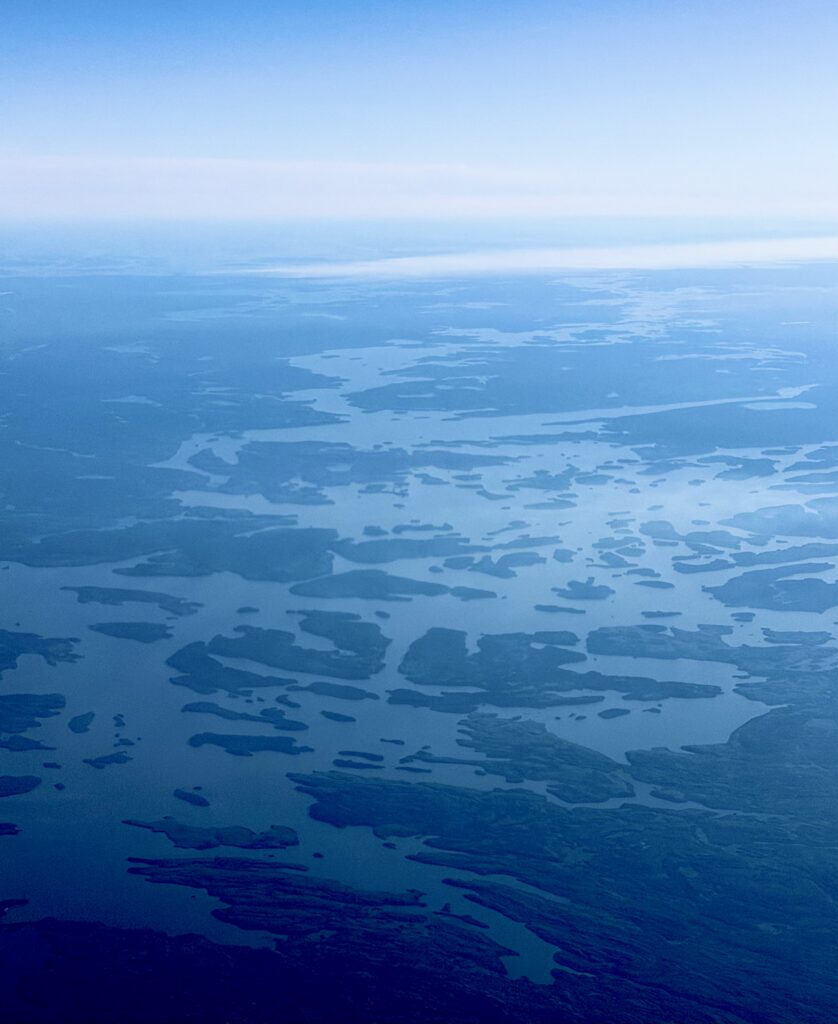
As promised, conditions were rough out on the lake. A strong headwind that created large breaking waves whenever the wind could blow across more than a few hundred meters of open water. Consequently, I snuck along the shore for.much of the afternoon, only covering about 5 km as the fish swims or 3 km as the bird flies.
In the distance, I saw the fishing boats from Kasba Lake Lodge dodge behind islands and seek the lee to stay out of the big waves. Everyone was having a rough go of it today and I hope tomorrow is easier. The spruce trees were definitely swaying wildly along the shore – a sure sign of high wind just a little further out to sea.
After this shakedown cruise, I made camp on a small island behind a dense lump of spruce that blocked some of the wind. I spent the rest of the evening re-organizing my gear and making the little adjustments that happen in the early days of every trip.
I continually remind myself that while bears and rapids and forest fires are real dangers, the real killer of people out here is hypothermia and drowning on the large lakes. I will continue to push north but this portion of the trip will also take as long as it takes. The weather has the deciding vote here always.
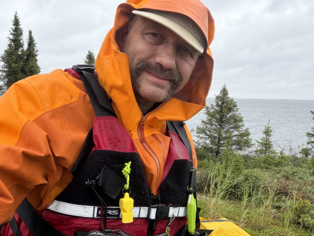
July 7th – The Real Journey Begins
Today there were loons, eskers, and patches of tundra appearing amidst the boreal forest, and it feels like home.
I paddled for about six hours today. From 8:30 to 11:30 AM I maintained a good pace despite the omnipresent headwind
. After a quick stop to stretch my legs in a beautiful patch of bouldery tundra I continued northward, but was not quite able to maintain the same pace. Preparation is really important, but ultimately only the activity itself can fully prepare you for the activity, therefore my plan is to start out with some easier days and then begin to ramp up the number of hours on the water. It would suck to get an overuse injury thus early in the trip.
The weather today was better than yesterday, but still mostly overcast and windy. The black flies are beginning to come out and I’m guessing that on a calm day they will be terrible. The bandanna tucked under the brim of my Tilley hat helps keep them off the back of my neck on the water, but shore breaks of more than five minutes now require the full on bug jacket.
With any luck, I will cross to the other shore of Kasba Lake early in the morning when the winds are low and then on to the outlet that feeds into the Kazan River. It’s tough going, but I am happy.
July 8th – Bug Season and I’m Now on the Kazan River.
The bad news is that it’s bug season. I broke camp and ate breakfast in a cloud of mosquitoes, and dinner was eaten in a swarm of black flies. Operating in this environment makes everything a little bit slower, but it’s bearable if you have the right clothing, a bug jacket, and sparingly use bug spray when you can’t protect your skin for some reason. Building little fires is another thing you can do: I don’t actually cook over them usually, but the smoke and carbon dioxide released by the fire, baffles the bugs and grants you a temporary peace.
The good news is that I have now finished the first stage, which was ascending Kasba Lake to the outlet. This was made easier today by millpond conditions out on the big lake, which is a rare thing. The Kazan River here is a medium sized stream, swollen from recent rains. I will be on it for about five days before I start making my way east to a different watershed. The Kazan here basically consists of swift and easy rapids connecting tiny little lakes.
The toughest of these rapids (the second hard left-hand turn after you leave the lake) was a good reminder of how bargelike my boat becomes when it has a 200 pound passenger and 200 pounds of gear in it. The Sea-1 is very fast on the flatwater for an expedition boat, but god help you if you get turned around the wrong way in the waves and are laboring to spin it back downriver. Until my load lightens a bit (ie I eat a good deal of the food) I think I’ll need to run the rapids with my folding kayak paddle rather than my heavy duty whitewater canoe paddle, just have a little more turning power and instant bracing ability on both sides.
Tomorrow I have more white water between here and Tabane Lake.
July 9th – Paddling and Sailing to Ennedai Lake
The first few days of the expedition are always a rude shock for the body. Even using the kayak paddle I just couldn’t maintain the pace of the first three days of the expedition. My shoulders hurt and my energy was tanking.
Near continuous headwinds in the morning and early afternoon today, but this river twists north, south and east, meaning that 20% of the time I could use my sail to ride the crosswind or even tack into the wind a bit.
My Falcon sail is very well designed and was incredibly when topography and wind cooperated to give me a break. But it is also the most dangerous piece of kit I am carrying and that includes a 12 gauge shotgun loaded with buckshot. If there is a sudden gust and you’re not paying attention, you’re going over, and in a large lake or in cold water that could be the end of here. Accordingly, I was in a low brace position the entire time I was sailing.
I was pretty much done physically by 3pm, but then the wind shifted just enough to allow sailing across Tabane Lake and from there I could ride the swifts to Ennedai Lake, the center of Ahalmuit inland Inuit culture in the first half of the 20th century. This is a giant lake and I can’t wait to explore it.
July 10th – Insane Bugs and Thunderstorms on Ennedai Lake
Today was supposed to be a bit of a rest day. Some easy, cruising, assisted by the sail, but when the wind died in the afternoon, I kept on going. I’ll feel like an idiot if I sit on shore on such a nice day because there certainly will be days of horrid weather in my future, and those are the days I should rest.
I pushed on for about 30 km and conditions became extremely hot. I started looking skyward for thunderheads and the bug came out with a renewed fury. Black flies, mosquitoes, and a shocking number of horse flies. On days like this, it’s better to live in multiple layers and sweat like a pig than get eaten alive.
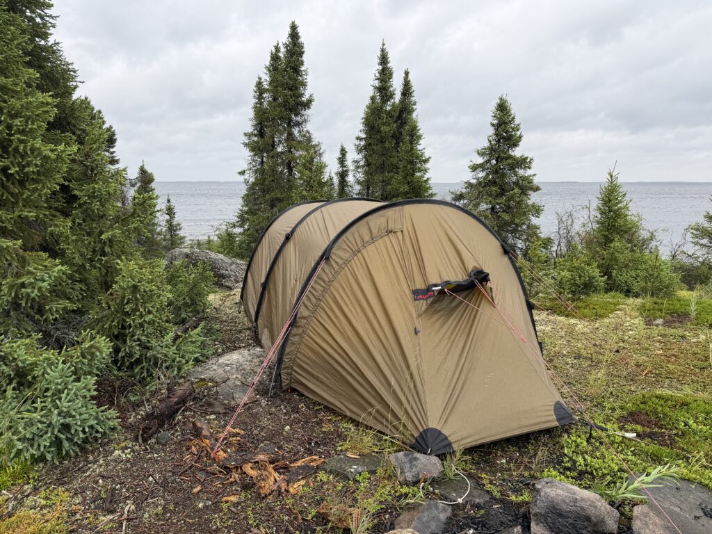
Dinner was a hasty affair because I saw a giant set of thunderhead approaching. Then I heard the rumbling of thunder all across the southern horizon and the first raindrops hit the tent a few minutes later. Now it’s the windiest I’ve ever seen it on the tundra and wind resistant Hilleberg tunnel tent seems like the best investment I’ve ever made. I’ve tripled and quadrupled the windward tent pegs and am in full raingear in case the tent starts shaking itself apart. It’s gonna be a doozy of a night.
July 11th – Battered by Storms
Last night from 10pm to midnight was wild as a giant thunderstorm proceeded along Ennadai Lake just north of my position. A creeping barrage of detonations accompanied by extreme winds and rain, but the Hilleberg Keron 3 tent held up magnificently. The The weather was still tumultuous in the morning but by early afternoon it calmed down enough to head out on the water.
Despite the extra sleep I’m feeling pretty depleted – 6 days of travel and not enough rest or calories (the bugs make lingering over dinner difficult) so I’m probably overtrained. On my first long solo canoe trip ever in northern Ontario 30 years ago, took half a day off every five days; perhaps it’s now time to take a full day off every five days.
I came across a gorgeous cabin on a bluff and, miracle of miracles, it was bugproof. I’ve had to set up my tent inside cabins before in order to stop the mosquitoes from eating my face as I sleep, but I don’t think that’s going to be required tonight. A fine place to rest up, and I’ll repay the owner’s inadvertent hospitality by tidying up the mess some animal made after it forced a window.
July 12th – Forwards to the Tundra
Whatever it was that eviscerated me yesterday was better today. It wasn’t the quality of sleep last night, actually that was pretty bad because it was too hot in the cabin, and I still had to get up in the middle of the night to erect my tent inside the cabin to protect my face from the mosquitoes that emerged from their hiding spots. Probably it was just a question of going too far too fast, and I need to ramp up the speed and time on the water consistently but slowly to give my body time to . acclimatize.
I’m still on huge Ennadai Lake but as I paddle northward, the trees become smaller and more sparse, and the patches of tundra grow larger. Today was a cloudy day, but this country would be so beautiful with beams of sunlight playing across the landscape. Maybe tomorrow that might happen.
Since people are always interested in bear precautions, in the second half of this video I go into detail about the five main things I’m doing to protect myself from black bears and tundra grizzlies, both of which I might run into at this latitude.
July 13th – Slow Progress on Ennedai Lake
I am a little bit worried by how little distance I am covering each day on Ennedai Lake. I have to get to the top of it to continue the trip, and I’m doing my very best but I seem to be getting repeatedly stymied. Today involved no less than four attempts to get going, as this rough schedule shows…
630 am, wake up, eat breakfast, excited to make good progress today.
730 am, big thunderstorm coming in, stop breaking down camp and back to bed.
12 noon, looks like the storms have passed so break camp a second time.
1:30 pm, actually on the water paddling north.
2 pm, another storm inbound right to my location, so I pull back to shore in a different place where I get poured on but also see the first caribou of the trip.
3:30 pm, back on the water.
4 pm, a giant thunderstorm occupying a third of the horizon is inbound. It looks like I might be here for a while so I set up the tent to weather the storm.
5:30 pm, storm passes, pack up the tent, back on the water.
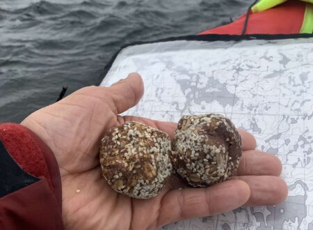
8 pm, make camp on a stunning tundra peninsula jutting out into Ennadai Lake. Bugs are very bad tonight and all the wood is wet making fire building slow, so dinner is a huge bite of Parmesan and two energy balls.
9:45 pm, in tent writing notes and repairing a broken bear alarm.
I don’t mind going slow per se, it gives me more time out here. But I do only have 28 days of food and there is still a lot of big lake upriver, overland, and then downriver miles left to do. Let’s see how much weight I’ve lost by the time I get home!
July 14th – Brutal Headwinds and the Abandoned Settlement of Ennedai
Better weather today but brutal headwinds. I labored into the wind for eight hours straight using my kayak and canoe paddles (I would periodically switched to give aching muscle muscles a bit of a rest) and although I did not cover a great distance, I think the effort and suffering quotient was met.
I am currently in the abandoned settlement of Ennadai. There is so much history here I’m going to have to relate it in a different format, but it’s kind of spooky to know that this was an inland Inuit settlement within living memory and now there is just an unmanned weather station. I wonder if the shards of caribou bone emerging from the sand are modern fragments or historic ones.
The landscape is definitely, changing as I go north. The size and variety of the tundra patches are growing; the trees are shrinking and are usually just found close to the water. As the spruce shrinks, the option for sheltered locations to camp in reduces as well, and one had better have a tent well suited for the relentless cold summer wind up here.
July 15th – Stunning Weather
Stunning weather for finishing the top part of Ennadai Lake and getting back on the Kazan River again. Hopefully I can make Dimma Lake and the big junction point by tomorrow. I’ve been putting in really long days and need to sleep now, it’s one of the few things I can do to allow me to recover from the continuous push.
July 16th – Finally Heading Upriver into Really Remote Country
Today is a huge inflection point for the trip. It’s the last day of following the Kazan River downstream and across lakes, and the juncture at which I start heading upriver into an extremely remote corner of the Arctic Barren Lands. I’m camped on Dimma Lake and the creek I’m ascending has no formal name I’m aware of, but try to connect Dimma Lake and Hicks Lake on Google Maps, it’s a maze!
I’ve been pushing it pretty hard these last few days trying to take advantage of good weather, but my body is getting worn down. My paddling output really plummets after about four or five hours on the water. I can still move forward, but man, am I ever limping long slowly. It’ll be interesting to challenge the body a different way for however long it takes to go upriver and overland to Hicks Lake and then see how my paddling muscles have healed and hopefully strengthened.
My campsite is beautiful tonight. I’m enough of a northern nerd to have my favorite kind of tundra to camp on and the bench above the Beech has that magical crowberry-arctic cranberry-dwarf Labrador tea heath. It’s not raining here, but distant cumulonimbus clouds are dissipating the heat of the day with rumbling thunder. And there are lots of Arctic wolf prints on the beach – maybe I’ll get lucky and see the pack!
July 17th – Wading and Tracking Upstream
The truth is that going upriver by canoe is a slow, tedious, and difficult affair. In fact, it took two hours to complete a section of river not even a kilometer long. Tracking a boat with ropes can be elegant when there is a walkable shoreline, but when you are navigating shallow rock gardens, you have to get into the water.
The river bottom is a very unstable surface with invisible randomly shaped boulders covered with algae and other slime, meaning that every third step slips off in some random direction and to a random depth. At the same time, your canoe is like a 200 pound disobedient dog that continuously wants to stop or turn around. You have to worry about not getting your arm or leg wrapped in the rope- because that could actually be lethal – while fighting off the mosquitoes and black flies.
On the other hand, it’s true that that as difficult as it is, proceeding this way is 1000 times easier than portaging through the willow swamp on the shores.
The weather today was unseasonably hot (hot enough to melt chocolate stored in a Ziploc bag and undercover in the canoe), which made being submerged in water a much nicer proposition. The sky was also very hazy, I suppose the results of massive forest fires burning in western North America. At times, I could actually smell smoke in the air, but I don’t think there are any forest fires close to me.
I have only recently started thinking about using helmets for wading and tracking upriver, but I’ve really come round to the idea now. I must have fallen down flat at least 10 times today, and while the lifejacket provides some protection for the body, I could see doing severe damage to your unprotected melon. I’m carrying a helmet anyway for the white water section of the trip, so it would be foolish to not pull it out now.
Tomorrow the upriver journey continues…
July 18th – At the Border of the Kazan and Tha-Anne Watersheds
By some measures I only covered a pathetic distance today; just 7 km or a little under 5 miles. At the same time I’m very satisfied with this distance because it included climbing seven of the eight remaining rapids between last night‘s camp and the next watershed. Some of those rapids took over an hour to ascend, explaining why the horizontal distance is relatively small. Tomorrow I have a couple hours of paddling and if that goes well, then I’ll be starting the first of four trackless portages from tiny lake to tiny lake to get to the headwaters of the very rarely travelled Kognac River.
This headwaters country at the borders of these two great watersheds is very pretty. Tonight I am camped between a lake and a great plain that stretches on the limits of your vision; it would not be surprising to see a band of horsemen ride out of that horizon except this a crowberry and lichen tundra, not the Eurasian grassland.
The last time I looked, the tundra had a few unripe blueberries hidden an inch off the ground. Today I look again and it’s an explosion of blue. The Arctic summer is so insanely brief, a couple of months for plants to flower and fruit, for animals to be born and grow strong, for trillions of insects to take to the air before the cold blasts of September cut them down. It’s a compressed timeline, and I feel honored to be out here for the peak of it, even if two of my wrists and one of my ankles look like they have smallpox because of blackfly bites.
July 19th – Terrible Blackflies
This right here is the crux of the expedition; the crossing from the Kazan River watershed to the Kognak and Tha-Anne River watershed through headwaters country. This involves navigating very shallow and very convoluted lakes that often require wading and dragging the boat over, barely submerged boulders in the middle of the lake.
The next stage involves a series of four portages connecting five little lakes. Obviously none of these portages are labeled or developed, and the deep Caribou highways that have been worn down into the soil over the millennia all go the wrong direction!
The first portage today was easy, a pleasant stroll over a tundra hill, but the next one is looking to be both longer and more difficult with much greater amounts of swamp, willow shrub, and dense, spruce shrub thickets, none of which are easy to carry heavy loads through. I’m going to go slow and steady and remind myself that 10 minutes of scouting can save me an hour of cursing and thrashing in the underbrush.
It had been very still and overcast conditions all day long, which are two things that blackflies absolutely love. Consequently, they hounded me all day and chewed one of my hips into a bloody mess when some flesh inadvertently got exposed there. By dinner time I had had enough, I would forgo a warm dinner imply wolf down some calories before retreating to my tent. Tomorrow is a new day and it will be interesting to see how far in this portage chain I get.
July 20th – Brutal Series of Portages Across the Height of Land
Well the headwaters traverse is officially done! There were 5 portages connecting 4 lakes, and I had to do each portage in 2-4 stages and do at least 3 loaded carries and 2 return walks for each stage. In total I did 62 shuttles between stations – feeling very tired now.
I’ve got to say that the weather was perfect for portaging today. It was a strong, cold north wind that simultaneously suppressed almost all the bugs, prevented me from sweating, and even gave me a bit of a push across some of the stages. It was so powerful for most of the day that I wouldn’t have been able to travel on the next lake anyway.
When I reached the end of the final portage, it was 5 o’clock, but the wind had dropped enough to help push me across to some tundra islands in the middle of Hicks Lake. I finally made camp by seven, ate by 830, and am now lying down as much as possible in the tent.
If I can get to the bottom of Hicks Lake by tomorrow, then I’ll be able to start the downriver run to the sea. It’s been 11 days since I’ve seen anyone.
July 21st – The Downriver Run to Hudson Bay Begins Today!
It’s about to get real! The weather gods smiled on the expedition and sent low winds that allowed me to get from the north end of Hicks Lake to the south where the Kognac River starts.
The shore of Hicks Lake was a special kind of barren. In parts an endless tundra stretched up and away from the lake, and in other parts it was a continuous field of jagged boulders. Nunavut does not do things in half measures.
I can see a little bit of current in the water now and it’s moving in the right direction, so this very exciting. My elevation is still 291 m or about 900 feet, and to get to icy Hudson Bay, which is at sea level (because it is the sea), every one of those vertical feet is going to have to be used up in current or white water rapids. Long story short: lots of rapids starting soon.
It was difficult to find a campsite because the upper part of the Kognac runs though a giant wetland. I am camped on a hummock a little higher than the rest, but given that it’s part sphagnum moss and that sphagnum really likes water, it’ll be an interesting night finding out if my undeniably wind proof tent also functions as an ark.
July 22nd – Sudden Squall on Hicks Lake
Saved by risk management! In my book, Perseverance, Life and Death in the Subarctic, I wrote about the principle of always staying one step below your limits when you’re in marginal conditions without hope of hope of meaningful help or rescue. And boy did that principle ever save my ass today!
I was making good time down the Kognac River and reached the part where it widens out into Elliott Lake. Suddenly there was a powerful gust of wind; still manageable but not if it got much stronger. I was one step below my limit and so I pulled over into a small cove.
At that moment there were a lot of unknowns. I did not know if the wind would get stronger or die down. I did not know whether the shore of Elliott Lake would offer much refuge or even a place to safely land. And I didn’t know what the force of the wind would be when it was multiplied by the fetch – the distance it would travel over water – if I ventured further out on the lake.
The shore did not allow anywhere to squeeze a tent between the giant angular rocks, but just offshore there was a little island with a patch of tundra at its apex. That’s where I pitched my tent in a hollow and watched as the wind got much, much worse. It also started to slash rain.
Did I do the right thing? In this case, given that the weather worsened, absolutely yes. But you can’t judge the quality of a decision purely by its outcome; even if the weather had turned balmy and tropical then pulling over under those initial observed circumstances would still have been the right thing to do.
July 23rd – Battling a Day Long Headwind
After finding a semi-horizontal spot on a tundra island just big enough for a tent last night, I spent the windstorm relatively comfortably. The big advantage of high winds is very low bugs so it was a pleasure to eat outside unmolested.
The wind persisted today, albeit with less ferocity. You can see this by the drunken dance that my drone did trying to keep me in frame, and this was during a relatively benign period the afternoon.
Today involved eight hours of paddling directly into a headwind which would have been unthinkable for my body a couple of weeks ago, meaning there has been adaptation. I got pretty tired in the afternoon, my cadence dropped and my form went to crap, but the boat kept on moving forward.
The river has temporarily dipped back down into the tree line. The dense spruce hedge where little trees about as tall as I am cluster together for mutual protection of the wind makes finding and accessing campsites much harder, but when you do find one there is abundant deadwood to make a fire and keep the bugs away during dinner. In the next couple of days the river twists north again on its winding journey to the Bay.
July 24th – Solo Whitewater on the Kognac
he first 90% of the day was slogging into an unrelenting headwind, and it was all redeemed by the last hour, which was a 10km section of continuous swifts and rapids.
Although I can run class four in an open canoe, I get as much pleasure on an expedition running class two rapids. The stakes when you’re carrying all your gear and supplies are high enough to provide quite sufficient thrill.
I am quite comfortable paddling a white water boat with a canoe paddle but the Sea-1 is designed for going in straight lines, especially when so heavily loaded. It turns very slowly, and the rudder is not often an asset in Whitewater, sometimes it’s actually a liability. That means I mostly use the kayak paddle because it gives me a little bit of extra power and a little bit of extra reach to turn this heavy boat in the waves.
Even so you don’t get many “moves” in your average rapid, you basically dodge the opening boulders and then pick a line to carry you through the rest.
Upcoming stretches of whitewater might have me using the dry suit I brought with me. That certainly adds time and complication, though, and if I zip up some black flies inside it they will chew me into a bloody mess.
July 25th – Rest Day on Hawk Hill Lake
I woke up with my lats, lower back, shoulders, and hands in pain. This shouldn’t have been too surprising really, given that I have spent 20 days underload with only one or two afternoons off due to storms. The stiff north wind blowing in across Hawk Hill Lake meant that paddling on would have been the third day of fighting headwinds in a row so that ended up making my decision quite easy; today would be a rest day.
I enjoyed a lovely walk up the tundra and limestone covered sides of Hawk Hill, got a stunning view of the lake and some of the rapids I had run yesterday, and watched the sunlight dapple the green landscape. I saw no hawks or any large animals really but the caribou trails wound their way through the vegetation all the way up.
Then I returned to camp and spent the rest of the day eating, resting and reading. By 8 o’clock in the evening the wind dropped, the black flies rose, and my body felt a little bit restored. Hopefully I’ll be able to put in a good day tomorrow and knock off the next two lakes and the significant stretch of whitewater that follows.
July 26th – Serious Whitewater Day
Serious whitewater ahead. Between Mountain Lake and Ducker Lake the Kognac drops almost 50 meters in 14 kilometers or about 17 feet per mile. That’s not a big deal in a kayak or a little play canoe, but in a heavy, unmanageable tripping boat packed with a more than 100 pounds of gear and food, well, it’s about the limit of what I would want to tackle.
To make matters worse, that drop is not continuous; sometimes it’s gradual, and sometimes the drop is concentrated in one part of one rapid. Looking at airphotos and using the drone for reconnaissance shows that there are some very serious river features ahead, and with some combination of paddling, lining, and portaging I hope to get safely past them.
Now THAT was some serious white water. The 14 kilometer (9 mile) segment of the Tha-Anne River ran through a valley with swifts interspersed with class 3 to 5 rapids. A swim here would be serious, especially if you’re doing it alone in a loaded boat like I am, because it would be very, very difficult to recover your boat.
The crux of the whole thing was a giant river wide class five ledge at the end of the canyon section. A tripping boat would go into this, disappear in the froth, likely smash into the bottom, then recirculate a number of times in a horizontal washing machine before being spat out much the worse for wear.
I knew this killer ledge was there and scouted it with a drone. At this water level it looked like there was a tiny sneak route on the far right and I decided to give it a shot. Getting to that sneak route, was difficult because access to it was guarded by rocks pushing me out towards the maelstrom in the center.
As you can see in the video I cut towards shore to get to the sneak route and then angled the boat to punch through the small hole at the bottom of the shoot, but there was little room for error. Honestly, if I do this river again I will probably line or wade the boat into position to run the chute rather than relying on paddling skills – what if there were a couple more rocks, guarding the route, or what if my paddle broke at the critical moment, or, or, or…
After pushing for 11 1/2 hours I found a beautiful place to camp with very few bugs on a sand and gravel terrace. Relieved and grateful that today went well.
July 27th – Wolverine Sighting
I saw a Wolverine today! I was extremely tired and was arcing the canoe towards a potential campsite with a nice gravel beach when I spotted something the size of a dog shambling and galloping over the tundra between tree clumps. He saw me too, stopped briefly to decipher my red boat, and then continued running West.
This is absolutely thrilling; I have spent many months north of 60 this is the first time that I’ve ever seen a live Wolverine. Its distinctive run in and the sense of how big this member of the weasel family is will remain with me.
After he disappeared, I realized I needed to continue. Strangely, my fatigue vanished so putting another couple of kilometers under the keel in the opposite direction of Wolvie was pretty easy.
Tonight I am bending the bear safety rules of the north. Normally, I separate my food into two waterproof bags and hide them separated from each other by a good distance. The rationale here is that if a bear finds one bag he probably won’t find the other and I’ll still have something to eat. The trouble with Wolverines is that they are notorious for finding and pillaging food stashes, so tonight I have both of my bags inside a double trip wire bear alarm system that should scare the crap out of him and give me time to use bear spray and noisemakers to drive him off.
The double trip wire system is also good practice for polar bear country, which is approaching rapidly.
July 28th – High Consequence Whitewater
The day started out cool and I had to wear a warmth layer as well as a raincoat as a wind layer. Soon the tic tic tic sound of thousands of black flies colliding with a heavy waterproof fabric reminded me I should probably add a bug jacket to the ensemble as well.
After a multi-hour push into a headwind I reached the end of Ducker Lake and the water channeled back into a narrow river valley. This gave occasional protection from the headwind and also meant that I was usually going with the current. The were, however, a couple of large rapids in the afternoon where bedrock outcroppings traversed the river creating some very serious hazards.
In the worst of these, the river separated into four or five channels that ran through jagged bedrock mounds that poked out of the water like the teeth of a giant dragon. Every channel had a serious ledge in it, creating a recirculating current, which is very dangerous for paddlers. It would’ve been difficult terrain to portage so I was glad that I found a solution whereby I could run the easier portions then line the canoe through the ledge drops. The length and weight of the canoe managed to punch through the froth and emerged unscathed downstream. Avoiding the portage was a small victory, but put a silly grin on my face for the rest of the day.
My energy had been flagging, but the dragon tooth rapid reenergized me and allowed me to push on through to a beautiful campsite on a spit jutting out into a slower portion of the river.
July 29th – A Goofy Caribou and Curious Arctic Wolf
Caribou and Arctic wolf sighting on the same day The caribou was feeding on the riverbank and noticed my boat floating towards him. He and I spent several minutes watching each other which he would interrupt by going back to eating. When he decided to run away eventually it was with the goofiest kangaroo side-to-side run you’ve ever seen.
The Arctic wolf I saw a few hours later was not scared at all. He climbed to the high ground, and then followed me down the river for quite a while until he lost interest. I have only seen three or four Arctic wolves before so this was really special.
We are conditioned from watching nature documentaries that there are animals everywhere in the wild, but that couldn’t be further from the truth. In the first three weeks of the trip, I saw two mammals: an otter and distant caribou running through the hills above Ennedai Lake. That’s it. Everything else was birds, fish, and billions and billions of black flies and mosquitoes.
In the past few days, however, I’ve seen a wolverine, a moose, a caribou, and now an Arctic wolf. Also, I saw my first sign of bear today: a giant dried up turd on the riverbank where I am camping The mammalian wildlife sightings are picking up!
Today was a long day because the winds were low, the current in the river was steady, and I wanted to make progress.
A few miles back the Kognac River joined with the Tha-Anne River coming in from the enormous Henik Lakes just to the North, essentially doubling the volume of the current. I think that was a location.
I have been carrying my parents ashes with me on this trip. My parents would have enjoyed this river junction so I spread those ashes into the current where they can float down to Hudson Bay and from there travel to any ocean in the world. It seems congruent with driving their camper van all over North America and booking a berth in working container ship travelling to Asia, Africa, and Europe. Have a good trip Mom and Dad, I love you and I’m very grateful for everything you gave me.
July 30th – A Cold and Wet Start to the Day
The weather started off very cold and wet today and I felt like spending the day in my sleeping bag. But the boat isn’t going to paddle itself and the only way I’m going to get down to Hudson Bay is by pushing through. I dressed up in full raingear and pushed off into the wet headwind.
After a really tough three hours, the weather improved, even giving me a tailwind by the end of the day. I pushed on until 8 o’clock because I didn’t want to waste that opportunity, but at the same time I realize the homestretch could take another four or five days so that I do need to be semi-well rested to push hard and keep the stupid mistakes to a minimum.
It has been 21 days since I last saw a human being and it doesn’t feel strange at all. At the same time, I am looking forward to seeing friends and family again reasonably soon, weather and whitewater permitting.
July 31st – The Weather Might Make Things Very Complicated…
Some not so great news out of Arviat today. I had been hoping to be at Hudson Bay in two more sleeps, but now I hear that there are strong easterly winds coming in tomorrow and staying for a few days. This is going to make staying on schedule very difficult, because from previous experience I know that these Bay winds can completely cancel out any kind of current pushing you downriver while at the same time making running the whitewater much more problematic; it’s one thing to ride the current and thread the needle between rocks and holes and ledges and curlers, but all this is made infinitely more complicated if a strong wind is blowing you all over the place, maybe exactly towards the hazard you are trying to avoid.
There is nothing to do but to continue on because every kilometer I can go now when the weather is half decent is one less kilometer I need to fight for tooth and nail when when this windstorm arrives. The question, as always, is how far back from Hudson Bay do I stage before the final push? Too far and I may not make it when the pickup boat is in the water, too close and I’m dealing with a significantly elevated threat of polar bears, the one bear described by science as “hypercarnivorous”.
It’s a fluid situation and there’s lots of time to think about this pushing on downriver
August 1st – In the Thick of Bugs and Canyons
I’m deep in the thick of it right now, making my way down a series of gorges with extreme rapids and waterfalls. The fact there is a massive headwind makes staying safe and travelling quickly a lot more difficult. I am currently spending a lot of time portaging, lining, wading and dragging. I am massively behind schedule, but that is way better than drowning.
August 2nd – Truly Massive Whitewater
This has been some of the hardest terrain I’ve ever had to cover. In this section, the river basically falls off of the bedrock plateau. It has been running through and create an insane number of massive rapids and waterfalls.
Now I’ve ran a fair amount of whitewater on this trip, but none of this was even remotely feasible. Much too much volume and ledges and boat-eating features These five rapids were all grade 5 or grade 6, and the definition of grade 6 is: “do everything right and you might not die.”
In a 12 km stretch there were five rapids that required portaging but just to get to the place to start the portage required waiting, lining, and dragging the boat over rocks. This section took two days and was made even harder by insane wins, gusting yesterday to 40 or 50 km/h. Try to get to an eddy above a waterfall to begin your portage with any kind of confidence in those conditions.
I spent so much time in the water that I am sincerely grateful. I decided to bring a dry suit. Most of the time it has sat in the canoe, taking up space, but in the last two days, it has been a lifesaver.
August 3rd – Forced to Camp on the Polar Bear Coast
After massive cascades the Tha-Anne widens. It’s energy spent, it now flows at a leisurely pace towards Hudson Bay for a meager 20 km, past high sand cliffs harboring thousands of cliff swallow nests. That sounds like an easy float, but of course it was not. The river celebrated my departure with gusty headwinds, thunderstorms, and downpours, and it was grueling work for my now much-depleted system.
This same ill weather meant that it would be much too dangerous for the two Inuit picking me up to head down the 100 km from Arviat, so I had to remain at the river mouth overnight.
This is the heart of polar bear country, especially the problem bears that Churchill relocates north, so I took all precautions. I set up the tent inside a ruined cabin to protect me from the wind and also to camouflage the tent a little bit – a new object appearing on the horizon might just pique a bear’s interest. I set up double tripwire alarms around the cabin to let me know if anything was sneaking up. I had a shotgun and bear spray beside me, and slept in my shoes and with a headlamp on my head to be ready for action. Then I tried to settle in for an attempt at peaceful wind-whipped night, serenaded by thunderstorms that had started at 2 pm and would continue past midnight, ready to spring into action if the bear alarm siren started wailing or I felt claws exploring the tent’s fabric…
August 4th and 5th – A Very Dodgy Pickup
The final stage of the journey. The bear alarm went off twice last night. To facilitate a fast response I was sleeping with my shoes on my feet and a headlamp on my head so I was out the door of the tent with the shotgun yelling like a maniac instantly, but there was not a polar bear to be seen; the trip wire had been hit either by a bush waving in the storm winds or by a fox patrolling the tundra. Needless to say it was not a very restful night.
The original plan was for the pick up boat to come all the way into the cabin, but what should have been a two hour trip from Arviat became a four hour odyssey through fog and chop and rollers, so by the time they arrived the tide was on its way out and they had to anchor outside of the river estuary. For context, these are 10 to 14 foot tides and the river estuary extends 6 km out into the bay.
In a canoe, you are so low down in the water that even a fairly large boat is essentially invisible until you are less than a kilometer from it, so it is actually kind of terrifying to paddle out into the unknown.
I paddled out to meet them and the further I went the stormier it got. The final quarter mile to get to the boat was particularly harrowing as I had the paddle through 6 foot tall breaking waves. I kept on thinking that it would be extremely ironic to swamp here, so close to the end of the journey.
Jamie and Cedric were waiting for me and got me on board. The journey back took about 4 hours and we pulled into Arviat about 9 pm. Jamie and his family kindly fed me, then got me to the airport the next morning. Now it’s time to readjust and process the lessons learned from these 30 days alone.
A thousand thank you’s to everyone who made this possible, from friends and family, Matt and Amy at Kasba Lake Lodge, the Kablutsiaks in Arviat, and all of you for following along.
Follow Along for Live Updates Future Expeditions!
Please follow on the platforms of your choice…
- Essential Wilderness on YouTube (I also put lots of long-form content on here as well).
- Essential Wilderness on TikTok (don’t worry, I’ve never done a TikTok dance and probably never will)
What Gear Am I Taking?
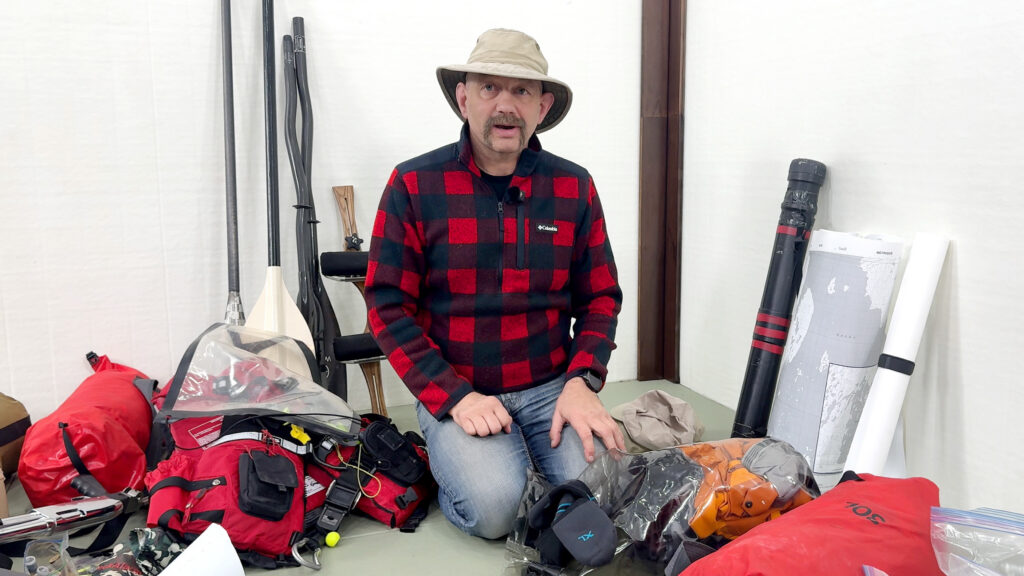
I broke down my food, gear, boat and paddles for this Tha-Anne expedition on YouTube in a video called All My Gear to Canoe Solo in the Arctic for 30 Days ($21,000+).
My 2024 Thlewiaza River Expedition
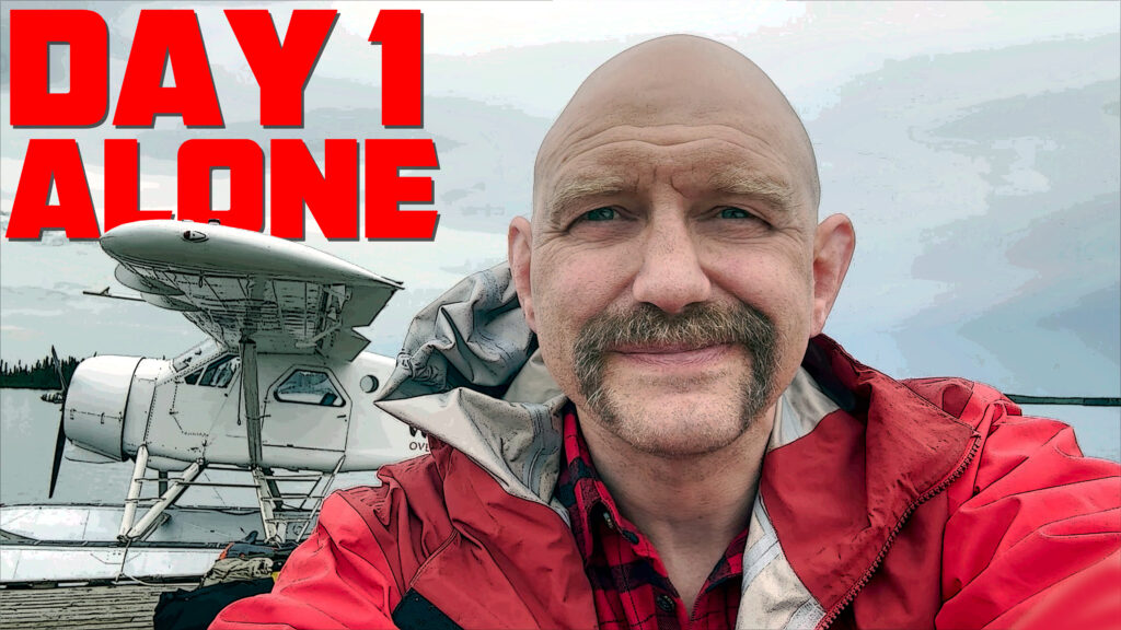
This trip from a few years ago took me across Nueltin Lake and down the Thlewiaza River. It’ll give you an idea of what I’m in for.
Perseverance, the Book in Hardcover, Kindle, and Audiobook Format!
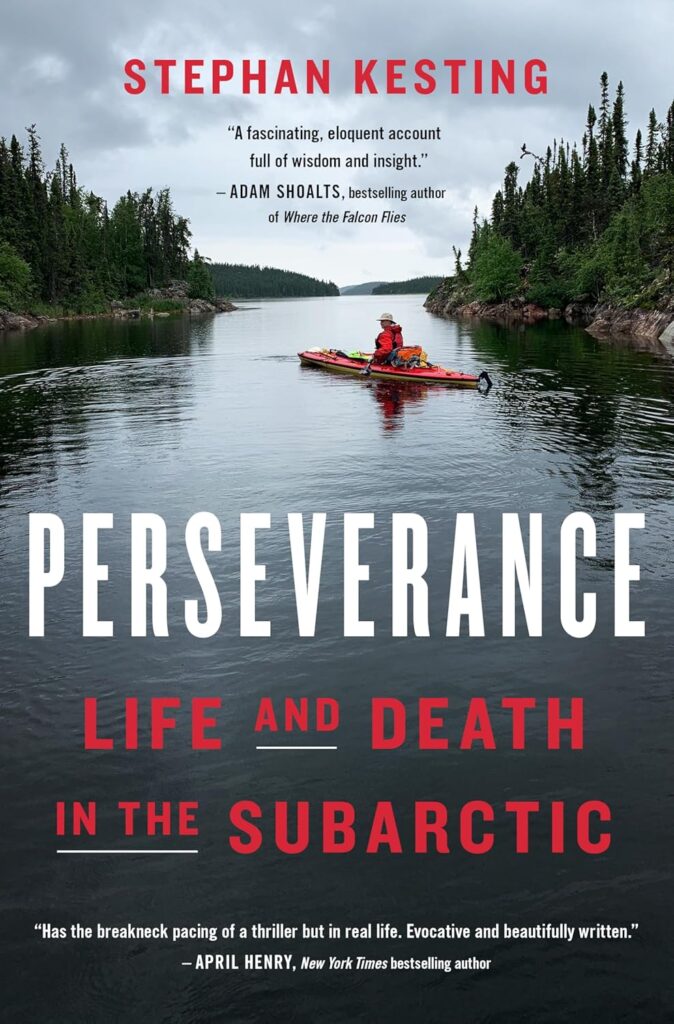
Click here to check out Perseverance on Amazon.
For the detailed story of my 42 day expedition on the Churchill, Reindeer, Cochrane and Thlewiaza Rivers I’d be thrilled if you’d consider taking a look at Perseverance, Life and Death in the Subarctic. It has received great reviews on Google, GoodReads, the CBC, and Library Journal.